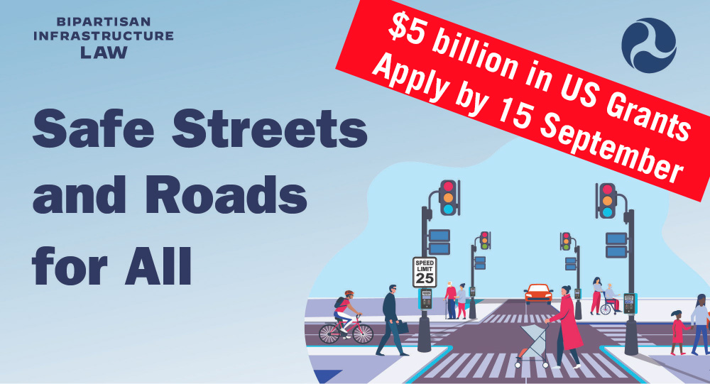
A new SS4A Grant Scheme is delivering $5 billion in funding over five years to prevent roadway deaths and serious injuries in the United States and iRAP Tools including Star Rating for Schools, CycleRAP and Star Rating for Designs Tools can beautifully support project applications.
The new Safe Streets and Roads for All (SS4A) programme was established under the United States’ Bipartisan Infrastructure Law (BIL) and will fund up to $1 billion in the 2022 fiscal year alone for regional, local and Tribal roadway safety initiatives.
Who is eligible to apply for grant funding?:
- Metropolitan planning organizations;
- Counties, cities, towns, and transit agencies or other special districts that are subdivisions of a State;
- Federally recognized Tribal governments; and
- Multijurisdictional groups comprised of the above entities.
Eligible activities include:
- The development or update of a comprehensive safety Action Plan.
- Planning, design, and development activities in support of an Action Plan.
- Delivery of projects and strategies identified in an Action Plan.
iRAP Tools provide evidence-based data to support Grant Scheme selection and reporting processes.
Star Rating for Schools (SR4S), CycleRAP and Star Rating for Designs (SR4D) are already supporting such activities in 75 countries, including the United States. The tools measure the safety Star Rating of roadways and school zones for pedestrians, cyclists, motorcyclists and vehicle occupants before and after improvement and inform evidence-based investment plans to eliminate high-risk road sections and prevent deaths and serious injuries.
There are two types of grants – Action Plan and Implementation Grants:
Implementation Plan Grants
Example activities identified in an Action Plan:
- Creating safe routes to school and public transit services through multiple activities that lead to people safely walking, biking, and rolling in underserved communities.
- Applying low-cost roadway safety treatments system-wide, such as left- and right-turn lanes at intersections, centerline and shoulder rumble strips, wider edge lines, high-friction surface treatments, road diets, and better signage along high-crash urban and rural corridors.
- Identifying and correcting common risks across a network, such as improving pedestrian crosswalks by adding high-visibility pavement markings, lighting, and signage at transit stops, in a designated neighborhood, or along a busy public transportation route.
- Transforming a roadway corridor on a High-Injury Network into a Complete Street with safety improvements to control speed, separate users, and improve visibility, along with other measures that improve safety for all users.
- Installing pedestrian safety enhancements and closing network gaps with sidewalks, rectangular rapid-flashing beacons, signal improvements, and audible pedestrian signals for people walking, rolling, or using mobility assisted devices.
- Working with community members in an identified problem area to carry out quick-build street design changes informed by outreach and user input.
- Supporting the development of bikeway networks with bicycle lanes for different roadway volumes and speeds that are safe for people of all ages and abilities.
- Carrying out speed management strategies such as implementing traffic calming road design changes, addressing speed along key corridors through infrastructure, conducting education and outreach, setting appropriate speed limits, and making strategic use of speed safety cameras.
- Promoting the adoption of innovative technologies or strategies to promote safety and protect vulnerable road users in high-traffic areas where commercial motor vehicles (CMVs), pedestrians, bicyclists, motorcyclists, etc. interact.
- Conducting education campaigns to accompany new or innovative infrastructure, such as roundabouts, pedestrian hybrid beacons, or pedestrian-only zones.
- Implementing standard and novel data collection and analysis technologies and strategies to better understand vulnerable road user (pedestrian/bicycle/transit rider) network gaps and to collect exposure data.
- Deploying advanced transportation technologies, such as the installation of connected intersection-based safety solutions and vehicle-to-infrastructure (V2I) advisory speed limit systems (e.g., Intelligent Speed Assistance [ISA]).
- Combating roadway departure crashes through enhanced delineation, shoulder widening, rumble strips, and roadside safety improvements.
- Evaluating and improving the safety of intersections by considering innovative design changes, improved delineation, and advanced warning.
- Improving first responder services with improved crash data collection, formalizing street names and addressing, and enhancing emergency vehicle warning systems.
- Unifying and integrating safety data across jurisdictions where local agencies share their crash, roadway inventory, and traffic volume data to create an analytic data resource.
Action Plan Grants
Communities can use Action Plan Grants to develop or complete an Action Plan or to conduct supplemental planning activities.
Example development activities include:
- Safety analysis of the existing conditions and historical trends that provides a baseline level of crashes involving fatalities and serious injuries across a jurisdiction, locality, Tribe, or region.
- Leadership commitment and goal setting that includes a goal timeline for eliminating roadway fatalities and serious injuries.
- Planning structure through a committee, task force, implementation group, or similar body charged with oversight of the Action Plan development, implementation, and monitoring.
- Engagement and collaboration with the public and relevant stakeholders, including the private sector and community groups, that allows for both community representation and feedback.
- Equity considerations developed through a plan using inclusive and representative processes.
- Policy and process changes that assess the current policies, plans, guidelines, and/or standards to identify opportunities to improve how processes prioritize transportation safety.
- Strategy and project selections that identify a comprehensive set of projects and strategies, shaped by data, the best available evidence and noteworthy practices, as well as stakeholder input and equity considerations, that will address the safety problems described in the Action Plan.
- Progress and transparency methods that measure progress over time after an Action Plan is developed or updated, including outcome data.
Example Supplementary Planning activities (must have an eligible Action Plan in place) include:
- Additional analysis
- Expanded data collection and evaluation using integrated data
- Testing Action Plan concepts before project and strategy implementation
- Feasibility studies using quick-build strategies that inform permanent projects in the future (e.g., paint, plastic bollards)
- Follow-up stakeholder engagement and collaboration
- Targeted equity assessments
- Progress report development
- Complementary planning efforts such as speed management plans, accessibility and transition plans, racial and health equity plans, and lighting management plans
The SS4A programme supports the National Roadway Safety Strategy and the Department of Transport’s goal of zero deaths and serious injuries on US roadways.
For more information:
usRAP, the United States Road Assessment Programme has already Star Rated nearly 64,000km and 82 schools, Risk Mapped over 98,000km and trained more than 1,000 people in how to make roads safer.


