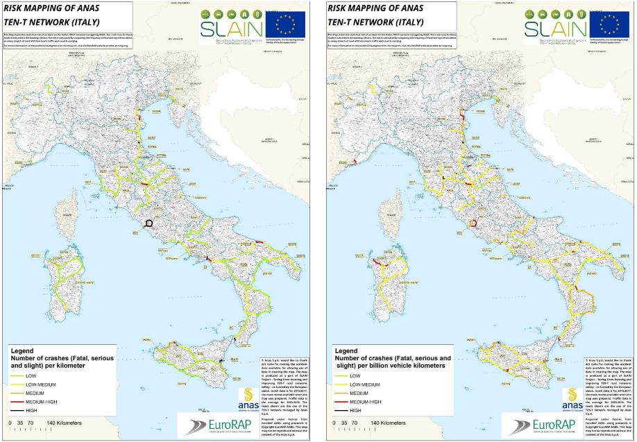
As part of the CEF SLAIN project, the first accident risk maps for the TEN-T network in Italy have been developed by ANAS. The maps represent the number of accidents per kilometre and the potential risk of future accidents.
The Maps show the statistical risk of accident on the Italian TEN-T network managed by ANAS. Crash data is for the 2015-2017 period, the most recent available. Traffic data is the average for 2015-2016.
The results are represented according to the EuroRAP methodology based on five critical levels ranging from low risk (green) to high risk (black).
In terms of the accidents’ density, both for the TEN-T core network alone and the whole TEN-T network managed by ANAS, more than 80% of the network has a low or medium-low risk in Italy.
High-risk network represents 13% of the core network and 4% of the entire TEN-T network.
Regarding the risk for future accidents, about 70% of both the core network and of the entire TEN-T network have a medium-low risk.
Southern Italy has lower risk levels, while the highest risk is in the central regions.
The subsequent elaboration of the maps, scheduled for December 2020, will allow a first evaluation of the TEN-T network performance.


