Article and image credit: iMOVE
The now completed Australian iMOVE project Accelerated and intelligent RAP data collection was a world-leading piece of work in the area of capturing road feature data for road safety star ratings, and a final report on the project, including its achievements, conclusions, and recommendations has been released.
About the project
The project was led by Transport for NSW (TfNSW), with research and assistance from the University of Technology Sydney, iRAP and Australian geospatial data experts, Anditi.
The work undertaken by the project is the first of its kind globally, and its activities and outcomes are of interest to stakeholders across Australia and around the world.
The many, many reasons for increased safety
The drive to make Australian roads safer is due to a horrifying set of statistics. Between 2016 — 2020, 5,935 people were killed on Australian roads. That alone demands attention and action. But a less-publicised set of numbers needs also to be taken into account. Annually, more than 40,000 suffer lifelong, debilitating injuries.
Anything that can be done to address these statistics demands assessment.
AusRAP, iRAP, and AiRAP
Just as the Australasian New Car Assessment Program (ANCAP) assesses the safety of cars on our roads, the Australian Road Assessment Program (AUSRAP) assesses the safety of the roads those cars will drive on.
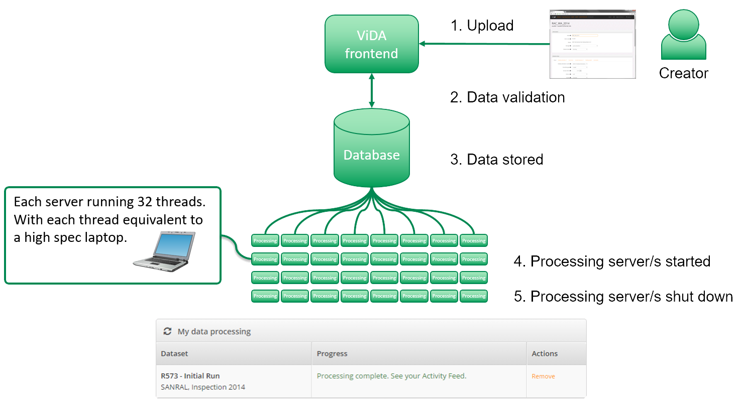
Transport for NSW already had access to the AusRAP data for 18,000 kilometres of the roads it manages. This project sought to use new methods to more quickly acquire up-to-date information on the state on those roads. These new methods would use iRAP and its tools. AiRAP-accredited data augments this existing framework, with the addition of “… accelerated and intelligent’ capture of road safety-related data using automatic, repeatable, and scalable methods.”
For this project TomTom’s MN-R data was used, in concert with extraction techniques and machine learning using LiDAR data and 360-degree imagery, capturing 20,000 kilometres of road attribute data for the state road network in New South Wales.
Use of this data will lead to:
- reduction of time and effort required to undertake road safety assessments
- reduction of costs and improvement of the accuracy and frequency of collection for performance tracking and KPI monitoring purposes
- improvements in road safety and the saving of lives
This project was run in a time of the UN’s Second Decade of Action for Road Safety, Australia’s National Road Safety Strategy and NSW’s Road Safety Plan, all three of which place road risk ratings as a critical component for road safety management and reporting.
The broader aim of the project was to do this within a scalable and repeatable framework for the benefit of other Australian jurisdictions at the national, State and local levels, as well as internationally. This was to be achieved through a new ‘AiRAP’ initiative lead by iRAP.
The AiRAP framework developed under this project would provide the mechanism for existing and emerging data sources to feed network-level road safety assessments throughout Australia and worldwide.
Project outcomes
The methods used in this project achieved the following:
- Delivered 20,000km of attribute data (7 attributes) using automated data extraction methods from existing data sources.
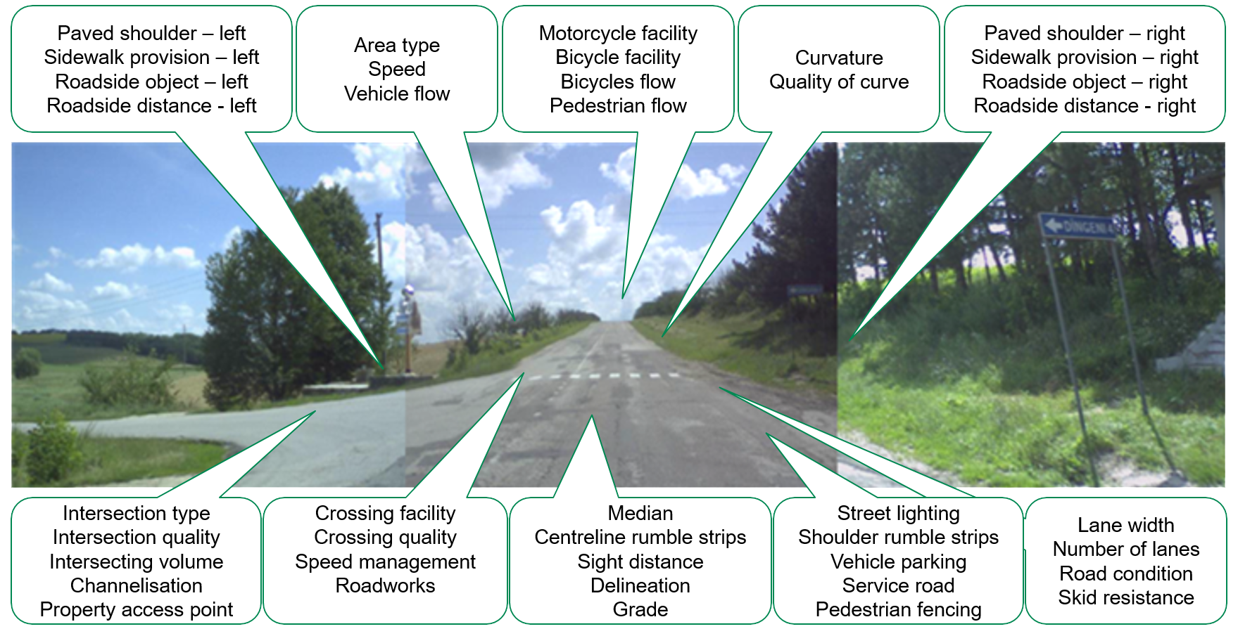
- Proved viability of extracting 52 Star Rating attributes using ‘off-the-shelf’ data with 34 of these being AiRAP-accredited for further use.
- Established an accreditation framework for doing the same for other data sources and suppliers.
- Mapped roads carrying 75% of vehicle travel for the State of NSW.
- Established a ‘light’ Star Rating method for network scanning for local government roads, and
- Mapped potential data providers and estimated cost savings and efficiency gains of using new data sources and extraction methods.
Phase 2
Building on these achievements, a second project phase is proposed, that will:
- Further develop capability for attribute data, especially speed and flow attributes
- Pilot light Star Ratings for local government road networks
- Continue refinement of AiRAP-ready attribute and category definitions and extraction techniques
- Use a data-driven method to model vulnerable road user flows
- Further develop the data marketplace
Learn more about the project methodology, findings, and next steps in the final report, AiRAP Automation for Australian Road Safety.
For more information on AiRAP and global R&D developments to advance the accelerated and intelligent capture of road safety-related data, visit https://irap.org/project/ai-rap/
