The UK’s Institute of Environmental Management and Assessment (IEMA) has offered guidance for the environmental impact assessment of traffic and movement for over 30 years, and a 2023 Guideline update recommends using iRAP Star Ratings or similar for Safe System application.
New guidance promotes proactive road safety assessment
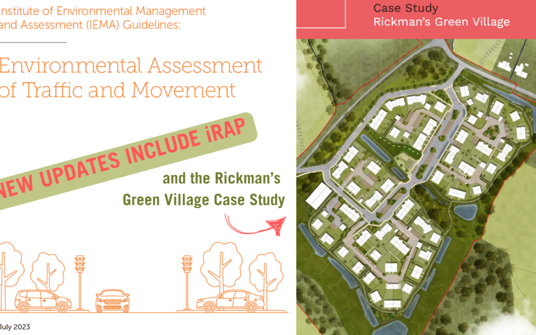
First released in 1993 and updated in 2023, the IEMA Guideline for the Environmental Assessment of Traffic and Movement provides practitioners with best practice advice on how to carry out the statutory and non-statutory assessment of traffic and movement impacts for a range of development projects, based on lessons learned over 30 years.
In addition to advice on traffic and movement, expert guidance is provided on related indicators including air quality, noise, vibration, health, landscape, biodiversity, cultural heritage, climate and greenhouse gases, as well as road safety.
The 1993 Guideline advocated the calculation of road crash rates as an approximation of the potential for road safety impacts, collisions and changes in traffic flows and composition.
Limitations of this traditional approach to road safety in the planning process include, for instance, that an assessment might note that there have been no recorded collisions within a five-year period along the frontage of a proposed development site. If a low number of crashes are recorded within the study area, it is often concluded that there are no significant road safety issues that could be exacerbated by the new development. However, historical collisions alone are not great predictors of future collisions which can be somewhat random by nature. This is exacerbated when you consider that in introducing a new development you may be increasing traffic volumes and increasing walking and cycling rates.
The 2023 Guideline update now recommends for proactive road safety assessment to meet the demands of the Safe System, for example using the iRAP Star Rating Methodology.
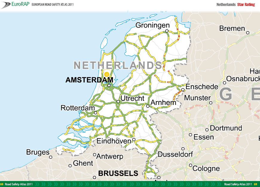
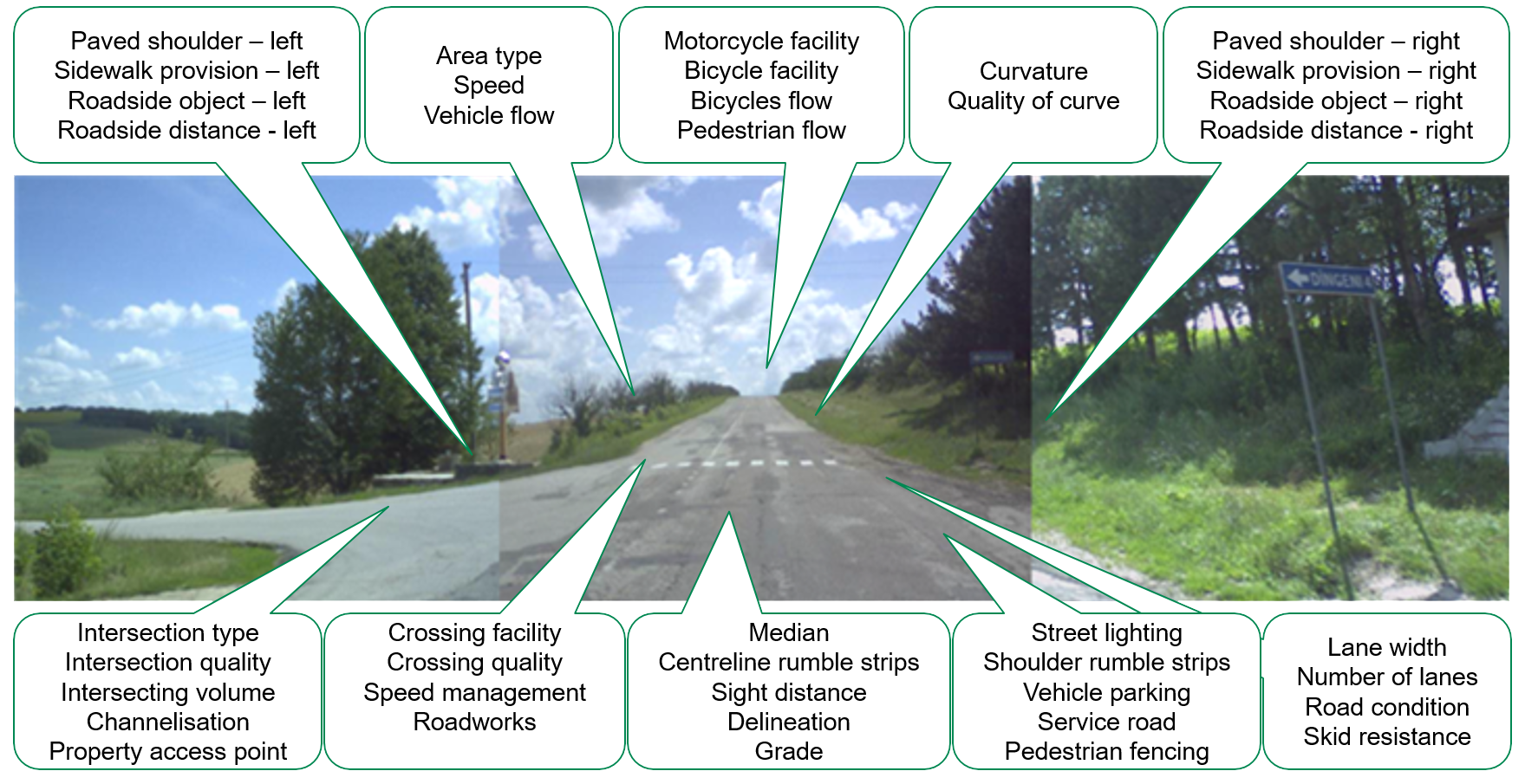
Star Ratings are an objective measure of the level of safety which is ‘built-in’ to the road for vehicle occupants, motorcyclists, bicyclists, and pedestrians. 1-Star roads have the highest risk and 5-Star roads the lowest risk. Star Ratings can be produced without reference to detailed crash data.
The Guidance recommends for evidence-based road safety modelling. This allows establishment of a baseline measure of road safety (before development), inclusive of proposed development scenarios, and a scenario where road safety mitigations are present.
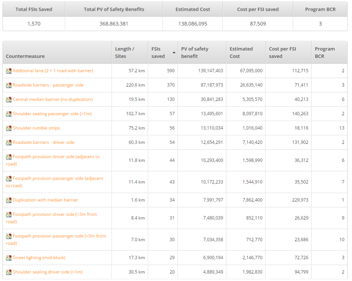
Final impact assessments can also present the estimated annual reduction in Fatal and Serious Injuries (FSIs) that could be achieved through proposed development.
The IEMA Guideline should be used by EIA practitioners working on projects in England, Wales, Scotland and Northern Ireland, and will also be useful to many international practitioners, particularly those applying the EIA directive.
iRAP Star Ratings positively influencing Development Planning: A Case Study
In the United Kingdom, any new building or infrastructure project must navigate a rigorous planning process. This involves submitting planning applications and adhering to the Environmental Impact Assessment (EIA) Regulations. Key documents in this process include the Transport Statement or Transport Assessment and the Transport and Movement chapter of the EIA report. The primary aim of these documents is to mitigate transport impacts, ensuring that new developments do not adversely affect the existing transportation network.
Aligned to the 2023 IEMA Guideline, based on the Safe System approach, the iRAP methodology was incorporated in the Environmental Impact Assessment for Rickman’s Green Village to ensure that roads associated with the new development will be safe for all road users from the outset.
Rickman’s Green Village Case Study
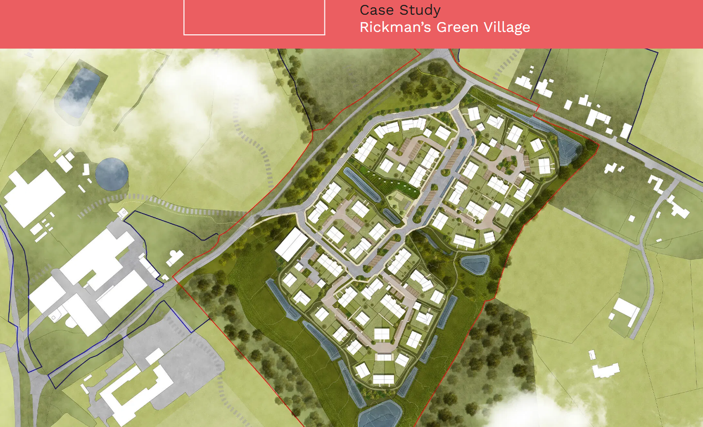
Image credit: HLM Architects
In 2022, Royal HaskoningDHV was appointed by Artemis Land and Agriculture Limited (“Artemis”) to provide highways and transport advice regarding Rickman’s Green Village located in Chichester District, West Sussex. Rickman’s Green Village is a proposed development project aiming to expand a farm to include office spaces, retail units, a primary school, and 600 houses in a very rural location. The client sought a highly sustainable development and was open to innovative approaches.
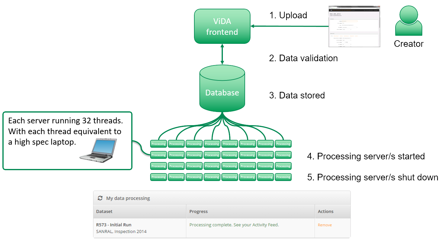
With the aim of achieving a more proactive and comprehensive assessment of road safety risks, Royal HaskoningDHV applied the iRAP Road Safety Assessment Methodology, rather than relying solely on historical collision data. The Star Rating was used to predict the road safety impacts (in terms of the number of fatal and serious crashes) of changes to land use, roads and increased traffic levels.
The planning process for Rickman’s Green Village adopted the “Decide & Provide” strategy to estimate traffic levels and evaluate the operational impact on every junction with 30 new trips. This approach considered road safety using Safe System principles and an evidence-led methodology.
Study methodology
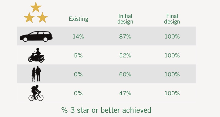
A baseline assessment was conducted using the iRAP Star Rating Methodology. This involved a quantitative assessment of road safety for different types of road users – vehicle occupants, motorcyclists, pedestrians, and bicyclists – at various sections and junctions. The baseline assessment indicated unsafe 1 and 2-star safety levels for all road users.
Based on the baseline assessment, proposed improvements were set out and tested. The impact of these improvements was then assessed with the development in place, considering mitigation measures to enhance road safety. The forecast Star Ratings based on proposed improvements showed 4 and 5-star safety levels could be achieved for all road users.
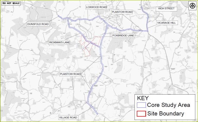
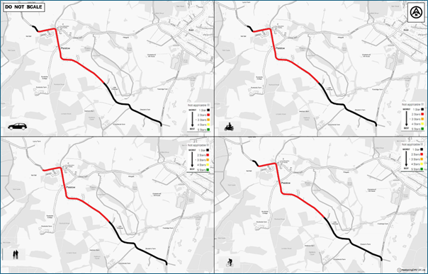
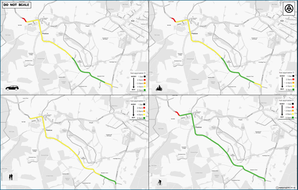
Core Study Area Forecast, Transport Assessment and the EIA Approach
Forecasts were made for the core study area, considering the baseline data and expected changes due to the development. This included calculating the significance of changes in road safety risk, assessing the sensitivity and magnitude of road safety impacts, and identifying specific improvements.
The transport assessment involved identifying a study area based on foreseeable impacts on walking, cycling, public transport, and horse-riding use. More distant locations were considered for necessary highway improvements as mitigation. The EIA approach used historic crash data to establish a baseline and assessed the effects of additional development traffic on all road users.
The final impact assessment calculated changes in road safety levels, estimating the annual reduction in fatalities and serious injuries (FSIs), done through proportional changes in FSIs and roadside hazards.
Conclusion
The integration of iRAP in the planning process for Rickman’s Green Village demonstrated a robust methodology for enhancing road safety in new developments. The approach highlighted the need for objective, evidence-led assessments and the importance of considering road safety from the outset of the planning process. This case study underscores the potential for iRAP and similar methodologies to drive positive incremental changes in road safety within the development planning framework in the UK and beyond.
iRAP tools support safety assessments for all road users including pedestrians and bicyclists, supporting active mobility, low carbon transport and climate resilience for people and planet. iRAP is supporting partners to implement the Global Plan for the Decade of Action for Road Safety 2021-2030 and drive forward the 2030 Agenda for Sustainable Mobility.
Support for IEMA Assessments
For assistance and information on applying the IEMA Guidance, contact Suzy Charman, Executive Director of the Road Safety Foundation on email suzy.charman@roadsafetyfoundation.org

