SLAIN Project -Saving Lives Assessing and Improving TEN-T Road Network Safety
1. Risk Mapping.
Objective = to produce maps showing total risk as an overall part of network-wide road assessment.
The task concerns the cartography relating crash data to traffic across the core TEN-T and if possible, the primary network in Croatia, Greece, Italy (on the core network of the Italian beneficiary ANAS) and Spain with particular attention to the Catalonian core road section. A Risk Map of death and serious injury will be produced for each country.
2. Star Rating.
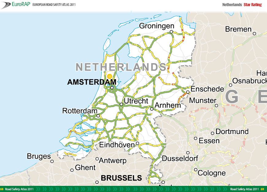
Objective = the production of maps showing the total risk as an overall part of network-wide road assessment, together with investment plans.
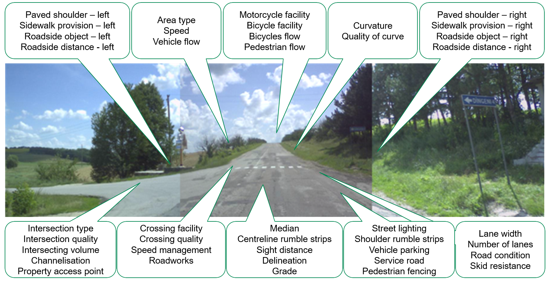
The work in this activity mainly involves the Road Survey and Data analysis leading to producing Star Ratings (SR) and Development of Safer Roads Investment Plans (SRIP). As Greece has recent data, it will not repeat this exercise.
3. Technical justification for network-wide road assessment
Objective = to compare network-wide road assessment alongside other methods providing information and know-how to countries who are yet to carry out network assessment.
There will be a review of different forms of network-wide road assessment and a comparison of these strategies with traditional “crash cluster” and “hot spot” approaches. This will use the data available from Greece and data from one or more other countries, subject to suitable data availability, to explain and provide a rationale for potential users of a network assessment approach.
4. “How to” guide for network-wide road assessment.
Objective = to build on material used in activity 3 to produce a step-by-step guide for the practitioner.
This is a guide which will explain the circumstances, data and steps required to perform a network-wide road assessment. It will be a document of approximately 20-30 pages presented in an easy-to-use and understand style that will be targeted particularly at policy-makers and those without first-hand engineering experience.
5. Global analysis of the safety of the TEN-T - research and mining of data from previous network-wide road assessment
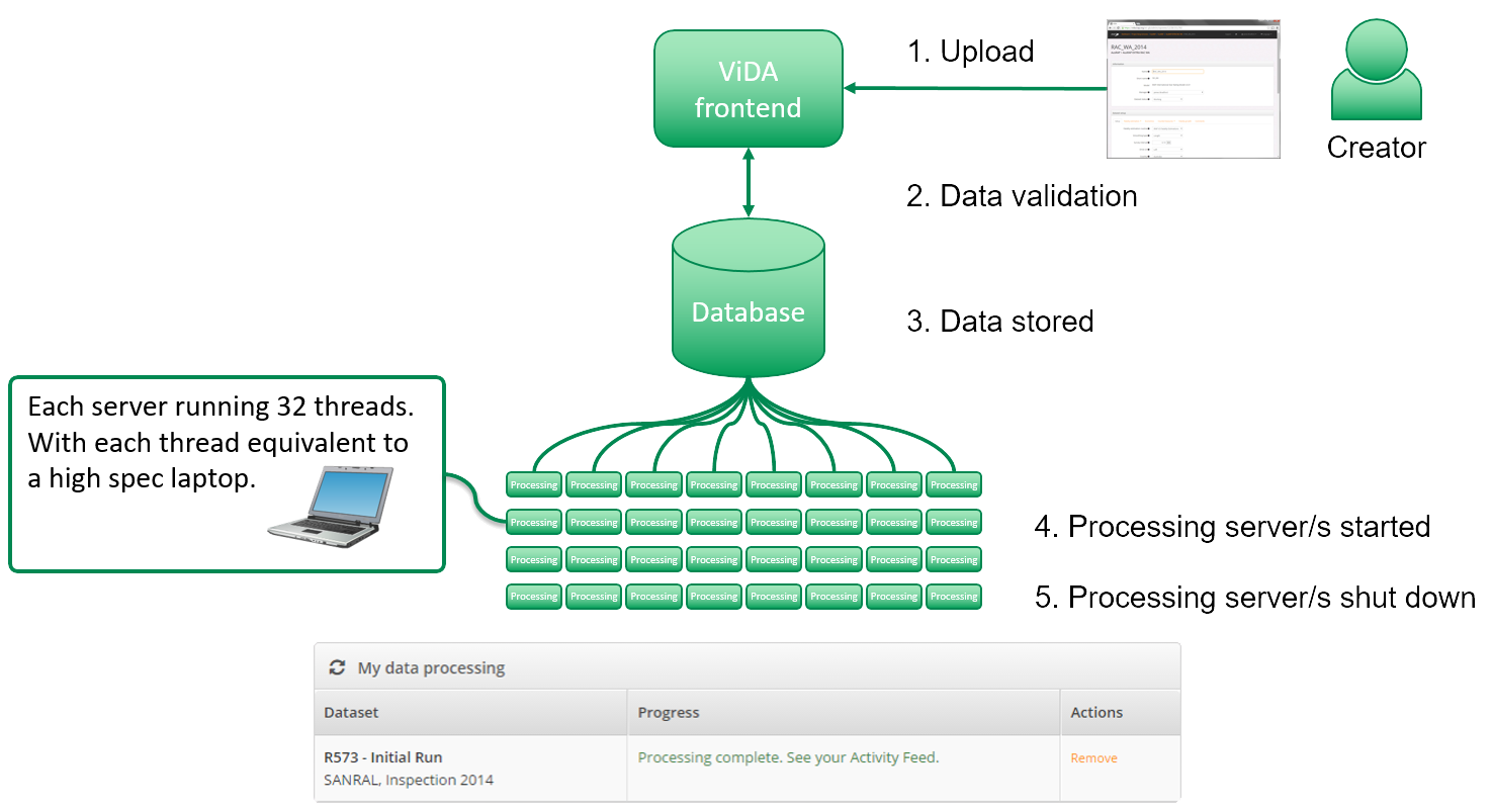
Objective = the production of a technical report. In particular, the report will include an analysis of road survey data for roads held in the iRAP ViDA data platform.
The purpose of this module is to provide to the European Commission a more formal estimate than previously available of the overall safety of the Core TEN-T and primary network and demonstrate what must be done to improve that.
A secondary objective is that, using data from Greece, it will be possible to show the detailed applications now possible within ViDA.
6. Case studies using the application of network-wide road assessment
Objective= the collection of a series of approximately 100 examples or case studies in total using the five techniques (A-E).
Case Study A: Risk Mapping to guide selective Star Rating
Case Study B: Before and after studies of network upgrading
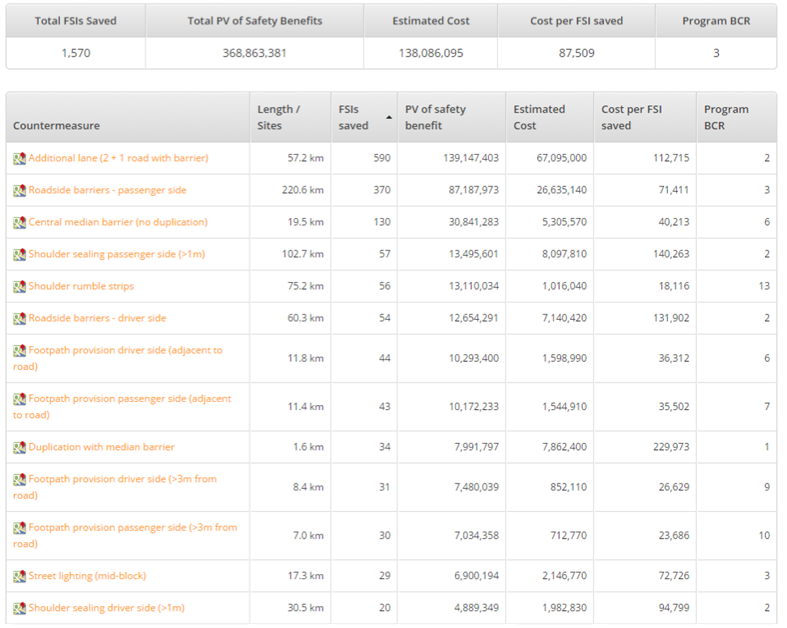
Case study C: Identifying road sections to install 2+1 barrier
Case study D: Maintenance-only remedies
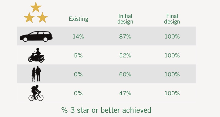
Case study E: Network-wide road assessment and Star Rating from design plans
7. Preparing the physical infrastructure for automation
Objective= to perform a three-part study to show readiness of physical infrastructure for automation.
Preparing the physical infrastructure for automation stresses the importance of the readiness of the physical road infrastructure for automation which should gradually be complemented by digital infrastructure.
Project management and dissemination of results.
Objective = to include continuous project management and communication and dissemination activities.
Deliverables
Brochure:
Presentations:


