Article reproduced from World Highways, 14 June – By David Arminas
Mobility software from PTV Group will be used by CycleRAP in projects to map cycling safety that will be run in five cities this autumn.
PTV said it is working with the International Road Assessment Programme (iRAP), the non-profit institution Fundación Mapfre and the Union Cyclist Internationale to run the CycleRAP risk assessment model.
CycleRAP, an evidence-based infrastructure risk evaluation model, has been designed to help cities better address the safety of their street and bicycle routes specifically for improving light mobility. In order to showcase best practices, the application of this model will be tested in Madrid and Barcelona in Spain, the Columbian capital Bogotá, Sao Paulo in Brazil and in Fayetteville in the US state of Arkansas.
The project works with local partners to identify network risks and produce maps showing how safe the infrastructure is for use by cyclists and users of other types of mobility vehicles. It will also be the first application of the model in Spain and outside Europe.
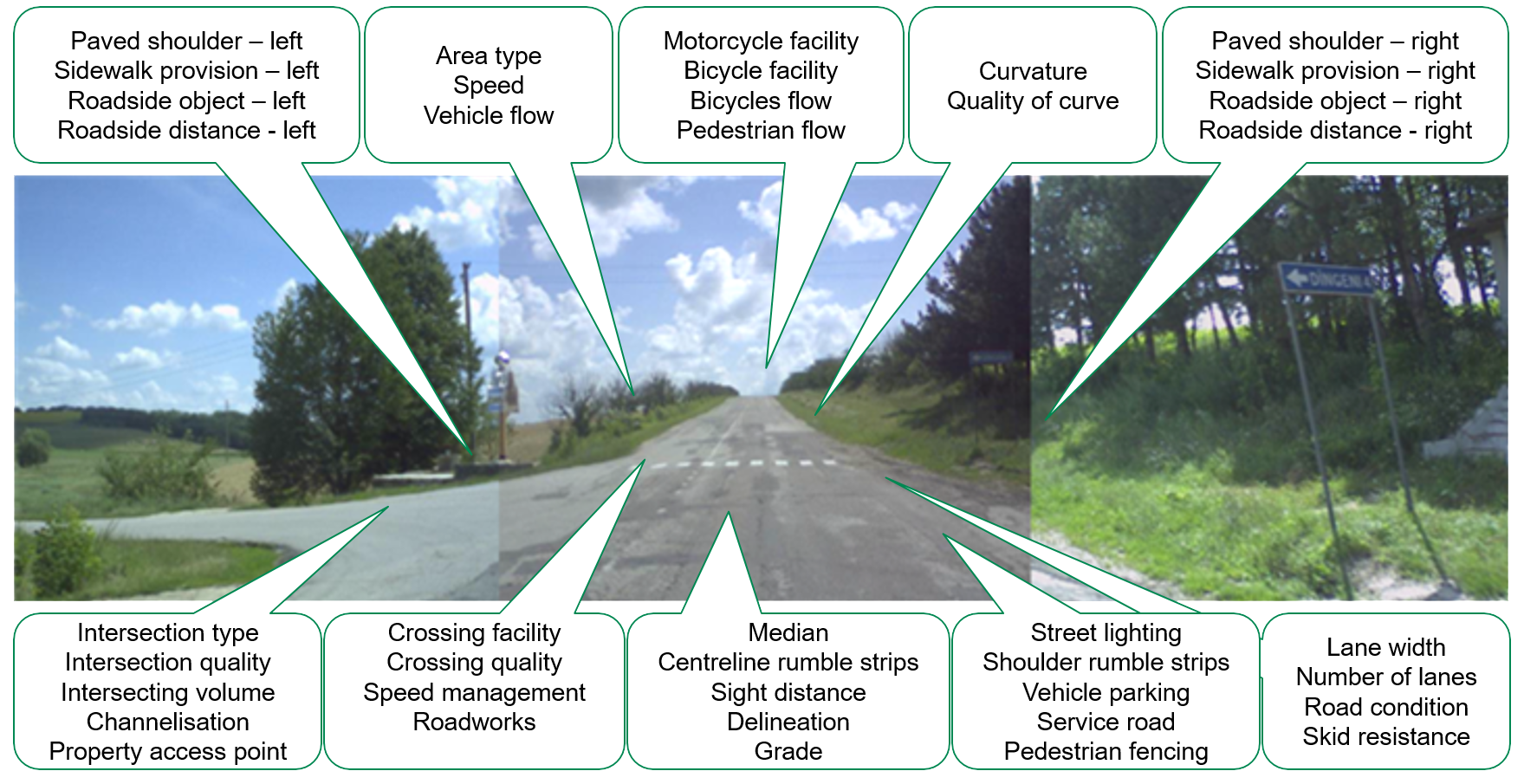
The model uses data about the features of a road, street or path to evaluate the risk of crashes for bicyclists and light mobility users – irrespective of the type of facility. It pinpoints and maps where crashes are likely to occur, offering suggestions for treatments to reduce this risk.
PTV will work with one of the pilot cities on the visualisation of the CycleRAP model results and evaluate infrastructure improvements. Based on the latest technology of PTV’s Model2Go, a model of the city will be generated using OpenStreetMap data for a detailed urban bicycle network configuration.
The CycleRAP analysis will then be applied in the multimodal network and analysis platform, PTV Visum, which the company says is well suited for managing, calculating and visualising bicycling corridor safety analysis.
The project results, due in October 2023, will give cities a clear understanding of how safe their infrastructure is, and provide key safety recommendations to help reduce risks. The project also aims to create a knowledge base to help cities replicate the approaches and improve safety of their cycling infrastructure. All the outputs will be launched publicly at the UCI Mobility and Bike City Forum, which take place on 25 and 26 October in Bruges, Belgium.
CycleRAP was launched globally in 2022 at the Velo-City Conference in Ljubljana, Slovenia, and the ITF Safer City Streets Network in Guadalajara, Mexico. It aims to reduce crashes and improve safety specifically for bicyclists and other light mobility users by identifying high risk locations without the need for crash data.
The high risks associated with urban cycling are holding people back from cycling as an alternative transport, said Sofia Salek de Braun, road safety ambassador at PTV Group. “The infrastructure must change, because we will not succeed in changing mobility behaviours if streets continue to be dangerous, and people are killed or seriously injured. This is why we at PTV Group warmly embrace this cooperation [within CycleRAP].”
Image credit: World Highways/David Arminas


