Main Roads Western Australia (MRWA) and Anditi have revolutionised road safety assessments with an approach that automatically detects road infrastructure data applied on 2,000km of roads in their goal of Star Rating 80% of the State’s most travelled network, An additional 19,000km of network assessments are planned for the entire State using LIDAR, and 390km of CycleRAP analysis. Follow up Star Rating assessments of 20% of the network will be undertaken annually to inform works and performance track success.
The results were shared yesterday at an Institute of Transportation Engineers – Australia and New Zealand (ITE-ANZ) webinar on iRAP Practical Investments Saving Lives. Fritha Argus, Research and Data Coordinator for MRWA, presented in the webinar on Technological advances creating opportunities for AiRAP.
In 2020, Main Roads WA partnered with iRAP and Anditi to design and develop a more automated, accurate and cost-effective solution for road assessment, to update roadside risk ratings and extract asset management data. The project analysed 2,000kms of urban and rural roads using Anditi’s iRAP Accredited RoadViewer technology and 3D Web Portal.
Speaking at the webinar yesterday, Ms Argus said the project and partnership reflected the power of collaboration, innovation and a commitment to improving road safety for all road users.
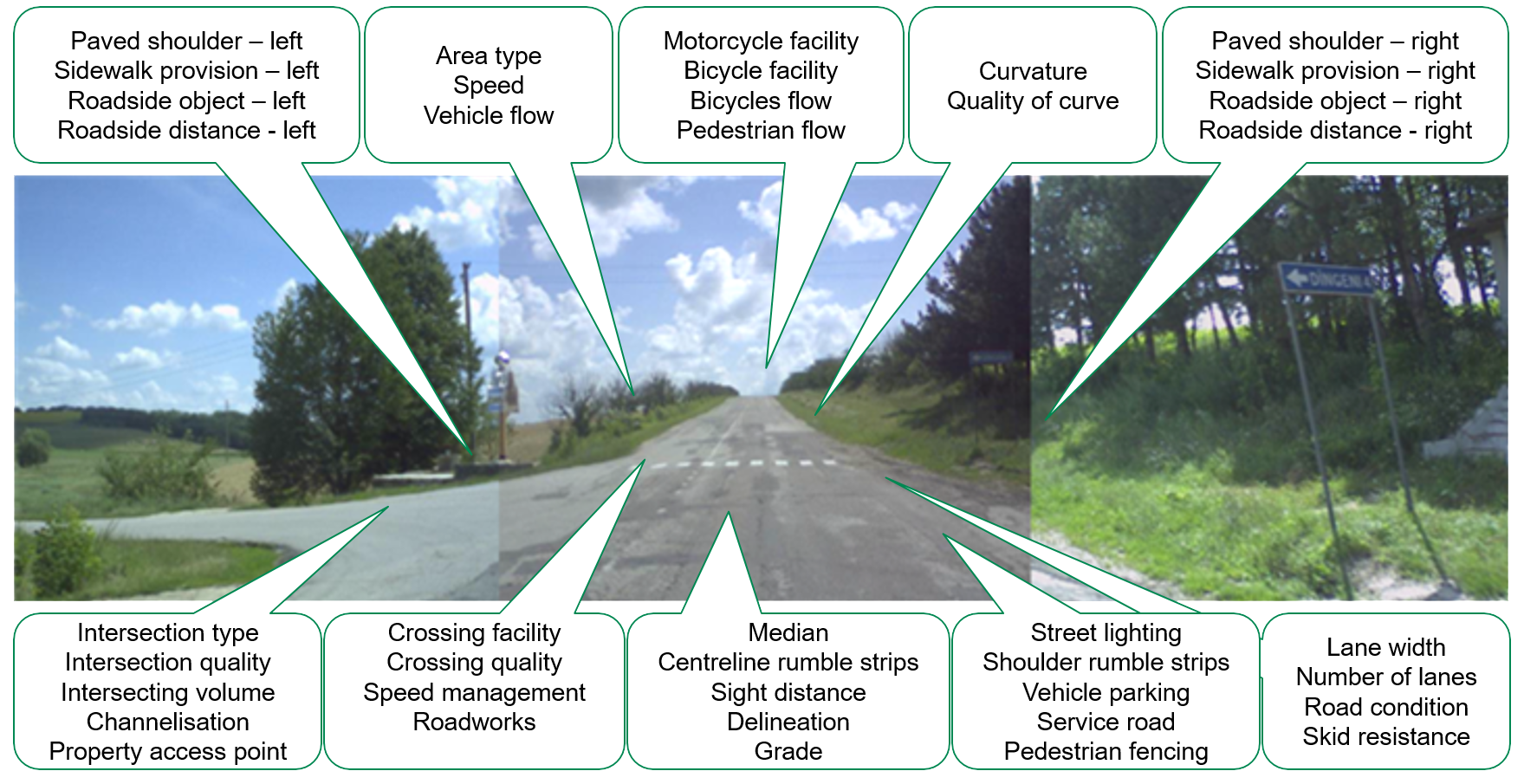
The world-first LiDAR-derived technology enables the automated extraction and visualisation of road safety attributes and asset data from Mobile LiDAR and 360 Degree Imagery. The technology captured median type and width, roadside objects, centreline rumble strips, intersection types, street lighting, trees, and property access points.
Ms Argus stated that, in the past, managing road assets meant that surveyors had to drive thousands of kilometres along the roads and record videos while observing roadside features.
She spoke enthusiastically about how their collaboration with iRAP and Anditi enabled them to expedite data accumulation, cut costs, and most significantly, allowed for scalability on their network with ease.
This approach adheres to the criteria of both AusRAP and iRAP Star Rating while reducing data collection costs by more than half. Moreover, it eliminates the need for manual data collection along these roads and thus enhances workplace health and safety.
Main Roads WA are taking steps to reach its road safety objectives, while also managing and accessing its geographic information resources to be able to assess their maintenance needs and ensure they adhere to regulations.
The timing of this project has been crucial for Australian road agencies. It aligns perfectly with the National Road Safety Strategy 2021-2030, which intends to halve fatalities and serious injuries per capita. Strengthening the security of infrastructure planning and investment, as well as regional roads, are essential objectives of the Strategy.
iRAP Global Innovation Manager Monica Olyslagers said, “The automation of data capture that has been developed through the project has the potential to make routine, large scale safety Star Rating assessments and Fatality and Serious Injury Estimates an integral part of the road asset management process.
“With faster and more affordable data collection processes, safety assessments can be performed annually across the whole network to inform road safety improvements and state and national policy and investment decisions,” she said.
Now the 2,000km pilot project is complete, Ms Argus shared next steps for WA:
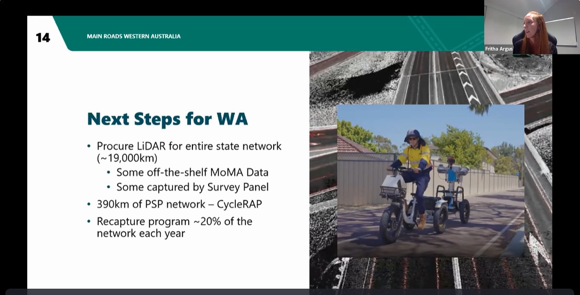
MRWA fitted a bicycle with survey technology to assess the safety of the shared path network using CycleRAP
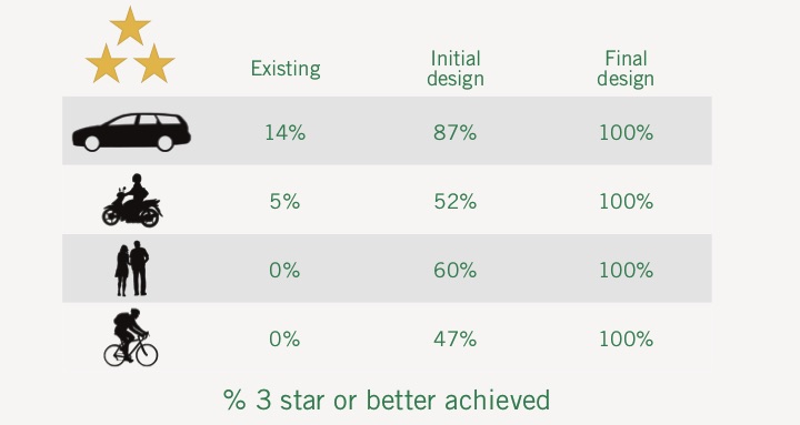
MRWA aims to strategically repeat Star Rating assessments on 20% of their network each year focussed on locations where works have recently been completed to provide an evidence-based measure of the safety improvement. They will also focus on areas where projects are about to commence to ensure engineers and designers have the most current network to inform their designs.
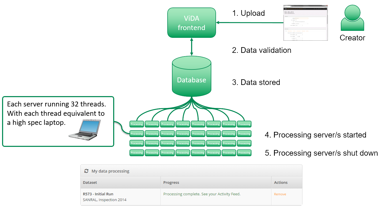
A new web portal is also being developed to house and share the 3D LIDAR data to enable all agency staff to drive the three dimensional network, take measurements and overlay other data such as Star Ratings, speed limits and traffic volumes.
The road attributes will need to be extracted from the LIDAR to enable the AiRAP Star Rating.
Ms Argus said the portal will facilitate further targeted analysis for strategic investment such as the prioritisation of rural roads for widening works based on shoulder width and clear zones.
“It will help us to easily identify the “low hanging fruit” – the simple countermeasures that can be rolled out quickly at relatively low cost to improve safety – such as sealing currently unsealed road shoulders,” she said.
“What we can get out of the resulting data,” Ms Argus said, “is not just going to help road safety but have many cross agency benefits. For example, it will help MRWA to do network and asset management such as locating, positioning and classifying electrical assets like power poles. understand speed management through analysis of speed sign locations, and target maintenance of line markings based on retroreflectivity condition. In terms of the environment, the data can highlight the density of roadside vegetation which can be managed to mitigate bushfire risk. Staff will also be able to take measurements from their desk to inform preliminary crash investigation saving time and their risk exposure, to improve health and safety. With less time in vehicles, fleet costs can be reduced as well as carbon emissions,” she said.
The project would not have been a success without the collaboration of various areas of Main Roads coming together to share their projects, progress and goals.
“It’s win-win-win-win-win for everybody, and being able to justify cross agency benefits can improve funding prospects, particularly in large organisations” she added.
