Library
Publications, Resources and Useful Information
For additional documents tailored to your specific country or region, we invite you to explore the iRAP Knowledge Portal, where you can access country-level insights, data, and supporting resources.
Search our library of resources here
2021-2030 Brazil Road Safety Plan (Pnatrans)
São Paulo’s 2025-2035 Road Safety Plan 2025–2035 (PSV-SP)
Recovering hope: New Narrative and Ibero-American Index of Safe Mobility (IIMS) 2026
2023-2042 Mexico National Mobility Strategy
Road Infrastructure Key Performance Indicators using the iRAP Global Standard
The recommended road infrastructure Key Performance Indicators (KPI’s) will ensure harmonised collection of data.
The True cost of road crashes – iRAP Report
Valuing life and the cost of a serious injury – This paper from Dahdah and McMahon provides a practical, useable answer for any country at any point in its state of economic development.
The Route Review Tool for user defined investment planning – a National Highways UK presentation
Presented at the Innovation Workshop 2026 by National Highways UK
Upload File Specification for v3.10
For v3.10 only – This specification sets out the requirements for road coding data files to be uploaded into ViDA.
iRAP Coding Manual for v3.02
For v3.02 only – Presents guidelines for the coding of road attribute data, which is part of the process of producing Star Ratings and Safer Roads Investment Plans (SRIP).
iRAP Star Rating and Investment Plan Manual for v3.10
For v3.10 only – Presents guidelines for the coding of supporting data, producing Star Ratings and tailoring Safer Road Investment Plans, analysis and reporting, performance tracking and implementation support.
iRAP Coding Manual for v3.10
For v3.10 only – Presents guidelines for the coding of road attribute data, which is part of the process of producing Star Ratings and Safer Roads Investment Plans (SRIP).
iRAP Methodology Reference Guide
This consolidated reference guide fully describes the iRAP models and risk factors, as well as the evidence which underpins these.
iRAP’s Privacy Statement
We take your privacy seriously and want you to understand our practices with respect to the handling of your personal data. This privacy statement explains how we do this.
iRAP Star Rating Model Update Explainer Note
Details the changes made to the crash risk models, risk factors and coding guidance.
UK A285 (Chichester to Petworth) 2021 Case Study
It is well known that different road features contribute to the likelihood and severity of crashes. Changing or upgrading these road features may reduce risk. This case study is one of a series carried out on roads in the UK to demonstrate a process of road assessment and crash reduction where Crash Risk Mapping can guide a selective Star Rating process.
UK A537 (Cheshire East) 2021 Case Study
E75 (NR-90, CH.182+400 – CH.184.600) 2021 (Greece) Case Study
The information detailed in this Case Study has been provided by RSI ‘Panos Mylonas’. The National Road 90 or North Road Axis of Crete (NRAC) is located on the island of Crete (South of Greece) and extends from one end of the island to the other (Kissamos to Sitia).
NR-7 Road (Asprohoma) 2021 (Greece) Case Study
Greece National Road 51 2021 Case Study
The information detailed in this case study has been provided by RSI ‘Panos Mylonas’. National Road 51 is also part of the European Network (E-85) and is the road connecting Egnatia Odos (E-90) with Bulgaria, at the north-eastern side of Greece.
Greece National Road 9 (Patras – Pyrgos) 2021 Case Study
Greece TEN-T road sections 2021 Case Study
The information detailed in this Case Study has been provided by RSI ‘Panos Mylonas’. Material in this case study is derived from the SENSoR study and as part of capitalisation of that project1 foreseen in the SLAIN proposal (section 2.2).
Rural road and motorways profiles 2021 (Greece, Hungary, Italy, Spain) Case Study
National Road 3 (Domokos) 2021 (Greece) Case Study
National Road 27 (E65 Thermopylae – Itea) 2021 (Greece) Case Study
This case study, provided by RSI ‘Panos Mylonas’, shows how Crash Risk Mapping guides selective iRAP Star Rating on Greece’s 45 km NR‑27 between Itea and Bralos.
Motorway A3, from junction Jakuševec to Ivanja Reka 2021 (Croatia) Case Study
This case study concerns the Zagreb bypass, motorway A3 section from junction Jakuševec to junction Ivanja Reka (Figure 1) where a Star Rating for Design Plans has been conducted.
Road sections of A6, A8, A9, D8 2021 (Croatia) Case Study
The roads and road sections selected for this Case study are a part of the Croatian TEN-T road network. These include three motorway sections (motorways A6, A8, and A9) and the state road D8 section.
TEN-T road sections with highest individual risk rates 2021 (Croatia) Case Study
This case study focuses on TEN-T road network sections in Croatia selected as a priority for analysis because they had the highest individual risk rates determined by Crash Risk Mapping protocol.
Risk Mapping to guide selective Star Rating – D8, Slano – Sustjepan 2021 (Croatia) Case Study
This case study has been supplied by FPZ. Based on the network-wide assessment using the Crash Risk Mapping methodology already performed, high risk road sections were identified. The subject of this study is the state road D8 section: Slano – Sustjepan which was selected based on relatively high risk rates determined by the Crash Risk Mapping protocol.
Risk Mapping to guide selective Star Rating – A3, Novska – Okučani 2021 (Croatia) Case Study
SS 309 Romea (Rosolina – Codevigo) 2021 (Italy) Case Study
SS 51 di Alemagna 2021 (Italy) Case Study
The information detailed in this case study has been provided by Anas. The case study shows a reduction in risk after implementation of maintenance and some additional measures added during that process.
SS 114 Orientale Sicula (km 110+000, Sicily) 2021 (Italy) Case Study
The information detailed in this Case Study has been provided by ANAS. The case study shows how a traditional crash “before and after” study on part of a network may be informed and enriched by the use of complementary iRAP data.
SS 13 Pontebbana 2021 (Italy) Case Study
The information detailed in this case study has been provided by ANAS. The case study shows how a traditional crash “before and after” study on part of a network may be informed and enriched by the use of complementary iRAP data.
SS 55 dell’Isonzo (Sablici – Gorizia) 2021 (Italy) Case Study
SE-40 (CH. 0+000 – CH. 41+300, Seville) 2021 (Spain) Case Study
SE-30 Highway, Centennial Bridge (CH.10+000 – CH.12+000, Seville) 2021 (Spain) Case Study
N-IV (CH. 558+500 – CH. 566+500, Seville) 2021 (Spain) Case Study
This case study, provided by DGT, outlines the N‑IV road—originally a single carriageway from Madrid to Cádiz—now mostly upgraded to the A‑4 highway under Spanish national authority.
A-318 Road (CH.60+000, Córdoba) 2021 (Spain) Case Study
The information detailed in this Case Study has been provided by DGT. The road A-318 is located in Cordova province (South of Spain) and connects A-92 highway (near Seville/Cordoba provinces border) and N-432 road. The road authority in charge is “Junta de Andalucía”, which is part of the Regional Government of Andalusia (Spain).
Corridor C-12 Road 2021 (Spain) Case Study
The information detailed in this case study has been provided by GenCat. It describes the identification of a road section suitable for the installation of a 2+1 lane configuration with a central median and comparison of potential treatment scenarios.
Corridor C-55 / C-58 2021 (Spain) Case Study
The information detailed in this case study has been provided by GenCat. It describes the effect of installing a 2+1 lane configuration with a median barrier and how the iRAP Star Rating protocol can be a valuable tool for testing the potential effectiveness of any planned countermeasure before it is actually implemented.
A-375 Road (CH. 7+450, Seville) 2021 (Spain) Case Study
The information detailed in this Case Study was provided by DGT. The A-375 road is located in the South of Spain and connects Utrera city with the A-384 highway (near Puerto Serrano town). The road authority is “Junta de Andalucía”, which is part of the Regional Government of Andalusia (Spain).
A-4 Highway (CH. 529+700, Sevilla) 2021 (Spain) Case Study
This case study, provided by DGT, examines a section of the A‑4 highway between Córdoba and Seville, selected for analysis due to crash risk and safety concerns identified through mapping and local data.
N-630 (CH.780+600 – 805+000, Sevilla) 2021 (Spain) Case Study
The information detailed in this Case Study has been provided by DGT. The road N-630 is an undivided carriageway road which connects Merida with Seville in the West of Spain. The responsible road authority is “Ministerio de Transportes, Movilidad y Agenda Urbana”, which is part of Spanish National Government.
Generic case of selecting sites for 2+1 with median barrier Road 4, south west of Debrecen – Ukraine border 2021 (Hungary) Case Study
This case study shows how Star Rating maps, Safer Roads Investment Plans (SRIPS) and tools within the iRAP software platform ViDA maps may be used to guide site selection for 2+1 roads with a median barrier.
Road 4, Nyíregyháza – Ukraine border 2021 (Hungary) Case Study
Cross-sections and mid-block National Road M2-R7 Saratenii-Soroca-Drochia Junction 2021 (Moldova) Case Study
This case study examines how design affects the Star Rating Score (SRS), which determines road safety levels (1–5 stars). It shows how SR4D can assess road safety before construction by evaluating design elements and user risk.
National Road M3 – Congaz 2021 (Moldova) Case Study
iRAP Accredited Supplier Code of Conduct
SR4S Case Study: Improved pedestrian facilities at Shohada, Imam Ali & Azmoodeh Primary Schools 2020 (Tehran & Mashhad, Iran)
SR4S Case Study: Moldova’s award-winning road safety initiatives -Transforming School Zone Safety with 30 km/h Speed Limits 2025
SR4S Case Study: Avoid Accident – Making School Zone Safety a Priority in India 2025
SR4S Case Study: Improved pedestrian facilities around IED Rodrigo Lara Bonilla 2019 (Bogota, Colombia)
Mexico’s National Road Network 2018 Case Study
El Salvador’s Coastal Highway 2018 Case Study
Belize City to Belmopan 2018 (Belize) Case Study
THE SWEDISH 2+1 with wire rope median 2020 (Sweden) Case Study
Sweden’s 2+1 wire rope median design has cut head-on crashes, reducing fatalities and serious injuries by 50% and injury crashes by 21%.
SR4S Case Study: TRAX India – Road Safety and Juniors project 2020
Government of Haryana, MG Motor and TRAX are developing a safer culture around schools through road upgrades, research and training involving students, teachers and the community, supported by SR4S.
SR4D Case Study: Central Cross Island Road 2021 (Samoa)
Case Study: Albania cuts road deaths by 23% with innovative road maintenance programme 2024
IndiaRAP Case studies of implementation 2020 (India)
IndiaRAP used star ratings to track road safety improvements, including projects on SH-20 (Karnataka), SH-55 (Gujarat), and safer road design in Mumbai.
RADAR Case Study: Risk Assessment on Danube area roads 2019
RADAR is a €2.15 million project to improve road infrastructure safety across 12 countries in the Danube region. The 3-year Risk Assessment on Danube Area Roads (RADAR) project is being run by the Slovenia-based European Institute of Road Assessment (EIRA).
Case Study: 3-star or better roads to save lives: IndiaRAP 2019 (India)
The majority of roads assessed in India rate 1- and 2-star for safety, indicating a significant level of risk. It is estimated that more than 80,000 deaths and serious injuries occur each year on this road network and there is a potential of halving this by implementing affordable safety treatments.
RAP Partnerships saving lives: Great Britain 2021
In Britain, there were more than 153,158 reported road casualties in 2019. Societal costs equate to 1.7% of Gross Domestic Product. The Road Safety Foundation (RSF) systematically measures and maps 53,000km of motorways and A roads each year to performance track the safety of Britain’s roads.
Case Study – RAP Partnerships saving lives: IndiaRAP 2020 (India)
Case Study – RAP Partnerships saving lives: MyRAP 2020 (Malaysia)
Case Study – RAP Partnerships saving lives: ChinaRAP 2024 (China)
Launched in 2008, ChinaRAP is a collaboration between iRAP and the Research Institute of Highway (RIOH), Ministry of Transport (MoT). It is now a world-leader saving lives and serious injuries through 3-star or better road infrastructure improvements.
Case Study: Shaanxi road improvements cut deaths by a third, injuries halved 2024 (China)
An Asian Development Bank (ADB) report reveals that a major road safety project in Shaanxi, China, reduced deaths by 33% and injuries by 53% on 850km of roads. This translates to 32 lives and 868 injuries saved annually.
Case Study: Bruce Highway Cooroy to Curra Section B, Queensland 2022 (Australia)
The Cooroy to Curra section of Queensland’s Bruce Highway in Australia used to be one of the deadliest highway stretches in the country. It is now one of the safest, improving from a 2-star safety rating to 4- and (20%) 5-star, following a State and Federal Government funded upgrade.
Celebrating wins – from local to global success
Road traffic injury is the leading cause of death for children and young adults aged 5-29 years. Around 1.35 million people die and up to 50 million are injured every year (WHO, 2018). Discover the safer roads and solutions saving lives and preventing serious injuries around the world through our Google visual story.
Case Study: Infrastructure Safety Improvements 2022 (Philippines)
In 2011-2012, with support from the World Bank GRSF, the Philippines Department of Public Works and Highways star rated about 6,000 km of national highways. Most roads were in the one- and two-star categories for all road users. As is common in Southeast Asia, pedestrians, bicyclists and local motorcyclists are at most risk.
2023 Annual Report: Celebrating partners’ global impact
As at December 2023, 1.8 million kilometres of Crash Risk Mapping and 1.8 million kilometres of Star Ratings of roads and designs (including 1,356 schools), have been performed by iRAP partners in 125 countries, informing the safety of over 100 billion USD of road infrastructure investments. 69,000 people have been trained. We are so proud to share the inspirational work of our 30,000 partners.
Case Study: Top 20 program 2024 (Australia)
AUD$560 million program funded by the Transport Accident Commission (TAC) and implemented by the Department of Transport. Roadside barriers, continuous median barriers, wide centrelines driven by proactive Safe System approach and improved AusRAP ratings. 77% reduction in fatalities. Star Ratings lifted from 2.9 to 4.5.
Case Study: Minera Escondida Road 2024 (Chile)
Project implemented on road connecting to the Escondida copper mine. Management of use employee transport to and from the mine and upgrades informed by iRAP assessments. Length 3-stars or better increased from 76% to 91%.
Case Study: Safer Roads Fund 2024 (England)
The modelled expected results from SRF 1, 2 and 3 are impressive, with the £200 million investment (with additional life operating and maintenance costs of a further £25 million) preventing an estimated 2,600 fatal and serious injuries over the next 20 years, with a value of prevention of injuries of £1.2bn.
Case Study: Thailand Highway 4028 2024
Project implemented by Department of Highways (DOH). Severe bus crash in 2015 led to roadside and median barriers installed. Deaths reduced by 100% (0 deaths after) and improved from 2-stars to 4-stars.
Case Study: iRAP and IDB collaboration 2024
Since 2010, IDB has financed 27,600 km of road assessments all over Latin America and the Caribbean. IDB has included Star Ratings in its road transport operations as an indicator for road safety improvement. Between 2010 and 2018, the IDB invested USD$880 million in road infrastructure along the Pacific Corridor, resulting in an increase in the share of 3-star ratings for all road users.
Case Study: Speed management and design in Bogota 2024 (Colombia)
Implemented by the City of Bogota, GRSF, and BIGRS. Informed by Star Ratings, upgrades and reduced speed limits in 10 arterial roads. Deaths down 22%.
6,410+ potential deaths and serious injuries to be prevented over 20 years.
Case Study: Belagavi-Yaragatti Highway 2024 (India)
Project implemented by Karnataka Government and World Bank. Multi-dimension approach: leadership, enforcement, training, communication, upgrades informed by iRAP assessments. Fatalities reduced by 54%. 54 lives saved per year and 124 injuries avoided per year. Increase in length rated 3-stars or better.
Life-saving case studies Croatia upgrades – Vodice Bypass 2024
Urgent fixes to the Vodice bypass will prevent 14 deaths and serious injuries and lift star ratings to 3 stars or better.
Case Study: Project SLAIN final results 2024
The SLAIN project results comprise the means for enabling partners to accomplish a common view and approach in deploying road assessment tools and to build on the material to support the discussions of both Directive 2008/96/EC and CCAM Single Platform.
Case Study: 3-Star or Better: Global Design Standard 2018
Reviewing road design standards, doing road safety audits, specifying minimum star ratings and applying safe system principles are proven to save lives.
R1 Trnava – Nitra (CH.0+000 – 38+200) 2021 (Slovakia) Case Study
Generic case of selecting sites for 2+1 with median barrier N366, StadsKanaal – Veendam 2021 (Netherlands) Case Study
How Star Rating maps, Safer Roads Investment Plans (SRIPs) and tools withing the iRAP software platform ViDA maps may be used to guide site selection for 2+1 roads with a median barrier.
National programme efficacy 2021 (Sweden) Case Study
How improvements to roads and roadsides can reduce serious injury and in particular the use of the 2+1 with wire rope median as used in Sweden.
Road No. 21, Vanneberga 2021 (Sweden) Case Study
How improvements to roads and roadsides can reduce serious injury and in particular the use of the 2+1 with wire rope median as used in Sweden and an example on Road No. 21 near Vanneberga in the south of that country.
Case Study: 5-Star Cities for all road users 2021
A 5-Star target for bicycling and walking and other road users can help provide an objective target and measure of safe and sustainable transport options for all transport modes.
Case Study: Oxley Highway Achieves Lifesaving Road Safety Gains 2025 (Australia)
A Transport for New South Wales (TfNSW) Case Study from Australia has shared the livesaving success of road safety improvements on the Oxley Highway which have reduced all severity crashes by 53 per cent and fatal motorcycle crashes by 67 per cent.
AusRAP Case Study: Princes Highway, NSW 2025 (Australia)
Transport for NSW used AusRAP to determine the highest risk sections of road to be prioritised for upgrades. Since 2015, significant upgrades have reduced the proportion of 2-star and 1-star roads by increasing their star ratings to a minimum of 3 stars.
World Bank Upgrades Case Study 2025: Tamil Nadu and Uttar Pradesh (India)
In Tamil Nadu, the proportion of roads rated 3 stars or better for vehicle occupants rose from 22 percent to 89 percent, while in Uttar Pradesh, this rating improved from 29 percent to 91 percent, highlighting substantial gains in design quality and road user safety.
Peru National Road Safety Policy 2023-2030
Cayman Islands National Road Safety Strategy 2023-2038
Department of Highways Sao Paulo 2030 Strategy (Brazil)
Brazil’s Draft Road Safety Guide in School Environments
Parana, Brazil State Concessions 2030 Strategy
Nova Dutra Concession auctioning with 3-star or better metric for safety (Brazil)
Brazil Government 3-star or Better Committment
IEMA Guidelines – Environment Assessment of Traffic and Movement (United Kingdom)
2022 National Highways strategic road network star rating report (United Kingdom)
Malaysian Highway Authority KPI for highway safety improvements
Indonesian National General Plan for Traffic Safety 2021-2040
ACRS Policy Position Statement – Infrastructure Star Ratings for Roads (Australia and New Zealand)
Victorian Road Safety Action Plan 2021-2023 (Australia)
iRAP Branding Guidelines
These Brand Guidelines define how iRAP is represented visually, verbally and through data. These guidelines work alongside the iRAP Star Rating & Risk Mapping Technical Standards.
Developing a Locally Owned and Led National or State iRAP programme
2018 EuroRAP – Roads that cars can read report III
Tackling the Transition to Automated vehicles 2018: This paper takes our knowledge of crash types and frequencies and considers how each might change as increasingly-automated vehicles enter the fleet.
2018 iRAP report – Road Safety Risk Assessment of Farm to Market Roads (Philippines Rural Development Project)
iRAP was invited to systematically assess risk on a sample of recently completed FMRs and FMR designs.
2018 PakistanRAP Star Rating Summary Report – iRAP Safety Assessment of National Highway 5
This report communicates the objectives and the results of the PakistanRAP assessments for National Highway 5 (N-5).
2019 iRAP report – Road Safety Risk Assessment of the Cagayan de Oro – Davao – General Santos Highway
iRAP was invited to assess risk on the national highway connecting the city of Cagayan de Oro – to the city of Davao “the provincial capital of Mindanao” – and to the city of General Santos.
2019 ThaiRAP Analysis report – Speed Variation Analysis: A Case Study for Thailand’s Streets and Roads
This report highlights how Speed Management is an important part of the Safe System Approach and how a simple speed variation can impact the safety of all road users.
2020 CycleRAP Research and Review – Evaluation and Literature Review Report
This report is the summation of a detailed evaluation of the CycleRAP model and literature review, with the aim of strengthening the link between the model and available evidence.
2022 Ai&Me Big Data Analysis: Methodology for Assessing High-risk Schools Report
This report aims to present the methodological steps and attributes used in big data screening approach of the Ai&Me Project, Vietnam.
2025 Ensuring roads are upgraded and lives saved: The keys to implementation success
This report initiated by GPAC outlines the seven keys to implementation success based on case studies from iRAP partnerships around the world.
iRAP Star Rating Model Update FAQs
Answers to common technical and data management queries.
RAPIDO User Guide – PILOT PHASE
RAPIDO is a tool developed by iRAP to enable quick, data-driven estimations of road safety risk across road networks and road corridors.
iRAP Crash Risk Mapping
This details the principles of the Crash Risk Mapping protocol, how networks are constructed and the rationale for the selection of routes and their related parameters in building a dataset.
Star Ratings for Road Safety Audit (SR4RSA)
The manual provides policy makers and practitioners with advice on how Road Safety Audits (RSA) and iRAP assessments can be used together during the design, upgrade, and rehabilitation of roads to meet safety targets and reduce injuries from traffic crashes.
Upload File Specification for v3.02
For v3.02 only – This specification sets out the requirements for road coding data files to be uploaded into ViDA.
Star Rating for Designs (SR4D) II User Guides
These guides provide instructions on how to use SR4D I and II, web applications in ViDA which can be used to code existing roads and road designs. Spanish and Portuguese versions of the SR4D II User Guide are coming soon.
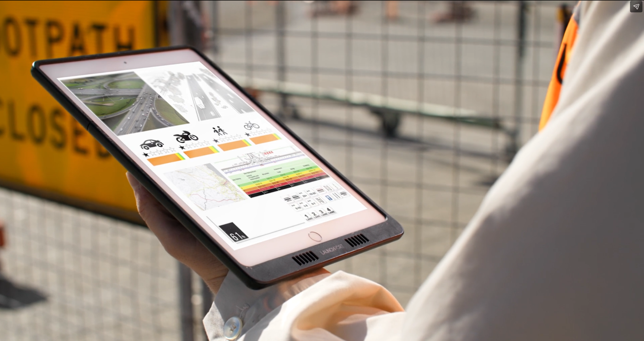
ViDA User Guide
Introduces ViDA, iRAP’s online analysis and reporting tool, and provides instructions for accessing ViDA, creating a ViDA account and accessing Star Ratings and Safer Road Investment Plan (SRIP) results.
iRAP Star Rating and Investment Plan Manual for v3.02
For v3.02 only – Presents guidelines for the coding of supporting data, producing Star Ratings and tailoring Safer Road Investment Plans, analysis and reporting, performance tracking and implementation support.
iRAP Survey Manual
Presents guidelines for the collection of road survey data, which is part of the process of producing Star Ratings and Safer Roads Investment Plans (SRIP).
iRAP Inspection System – Accreditation Specification
Sets out the requirements for an inspection system to gain iRAP accreditation, which relates to road surveys and coding systems that are used as part of the process of producing Star Ratings and Safer Roads Investment Plans (SRIP).
Standard Terms of Reference
Designed to assist those who want to undertake or procure iRAP-specification activities. It can be used as the basis of a project plan, contract and/or in the process of engaging practitioners to deliver services.
iRAP Road Safety Performance Tracking Manual
Provide practical guidance on using iRAP Star Ratings and FSI estimates to measure, compare and report road safety performance over time.
iRAP Project Planning Manual
This manual assists with the planning, preparation and management of a project for iRAP road assessment or related activities.