
Riesgo de Mapa de Crask
What is Crash Risk Mapping?
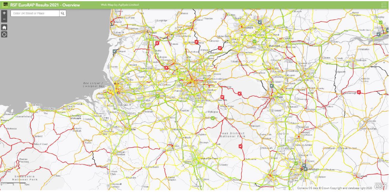
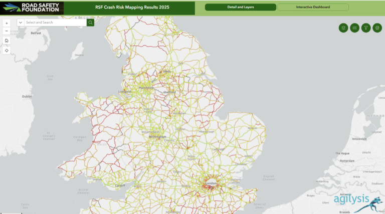
Crash Risk Maps use detailed crash data to capture the combined risk arising from the interaction of road users, vehicles and the road environment. Risk Maps provide an indication of the overall road system performance.
The maps provide an at-a-glance and objective view of where fatal and serious injury crashes have occurred and where serious crash risk is greatest. Using a global methodology allows benchmarking where desired (e.g. crash rates on motorways; pedestrian crash rates in cities). Primary metrics include crash risk per kilometre/mile and crash risk per kilometre travelled.
Crash Risk Maps and Star Ratings are often used together as part of a strategic approach to managing risk and investment. They also provide a useful source of calibration for FSI Estimates and Investment Plans.
Latest Crash Risk Mapping news
21 de marzo de 2024
25.000 km de mapas de riesgo de accidentes publicados para España
3 de febrero de 2023
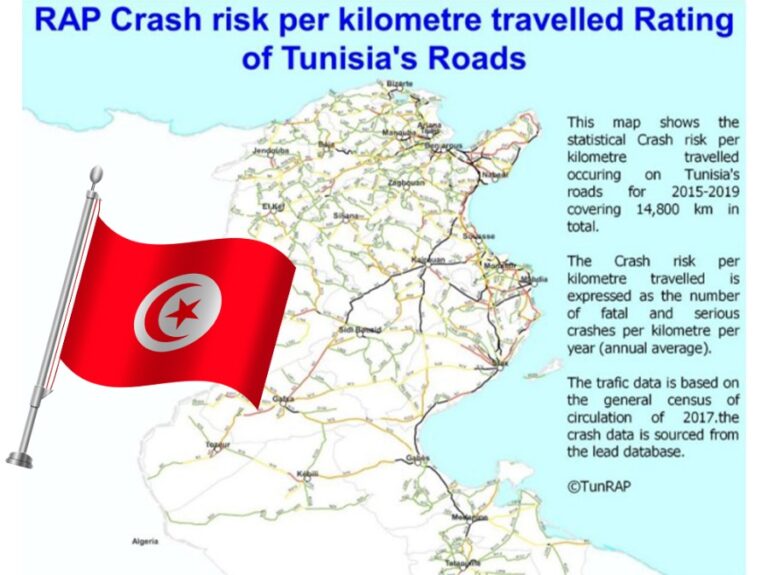
14.800 km de mapeo de riesgos de Túnez completado
19 de enero de 2023
21 años de seguimiento del rendimiento: publicados los últimos resultados del Mapa de Riesgos de Cataluña
18 de diciembre de 2025