Image credit (above and below): Chris Fossey Phtotography
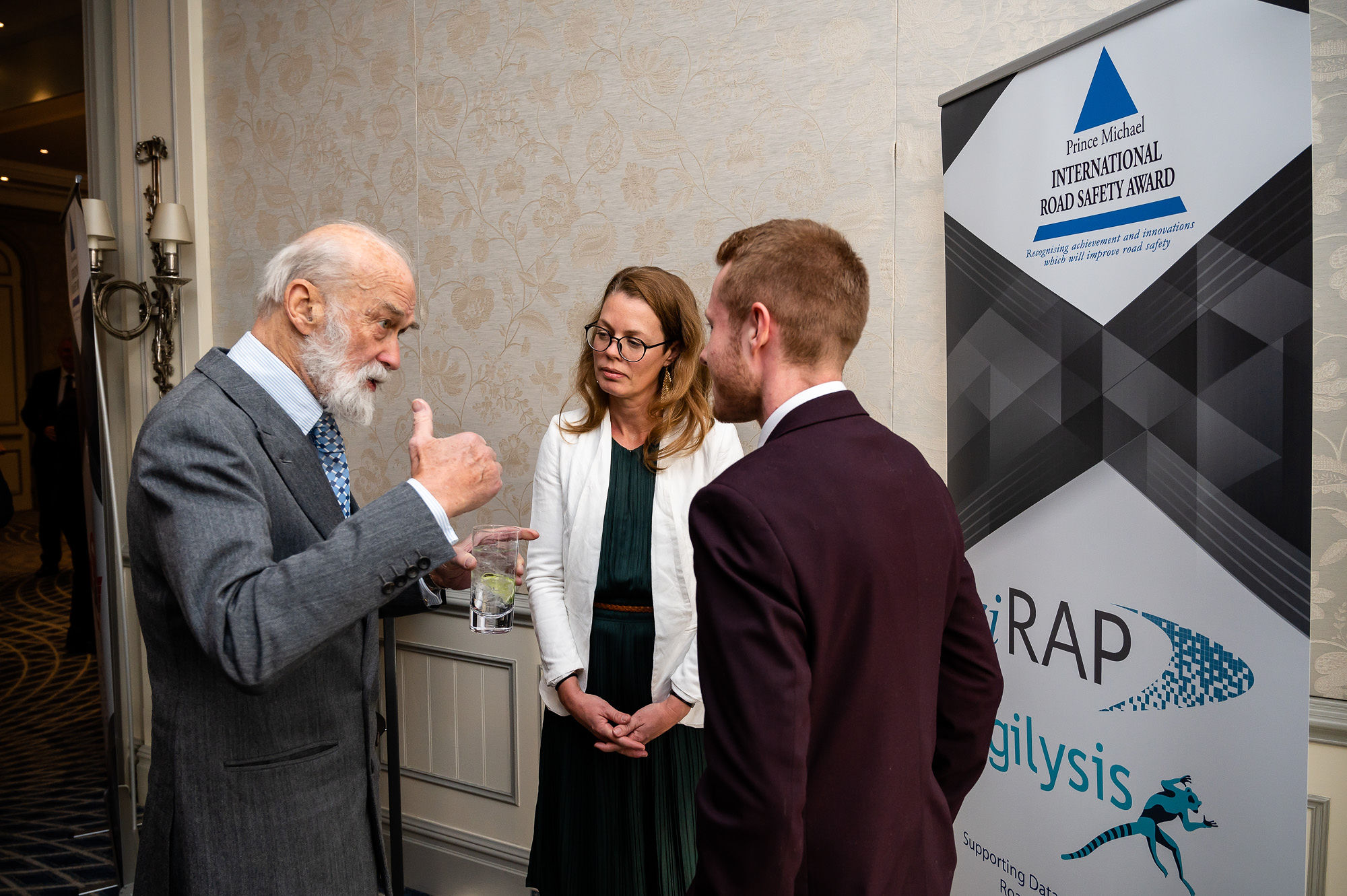
An innovative project, harnessing satellite imagery to understand road network safety has been recognised by the Prix Internationaux de Sécurité Routière Prince Michael.
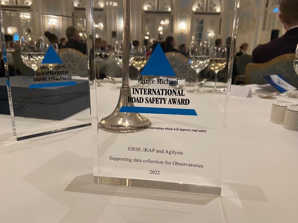
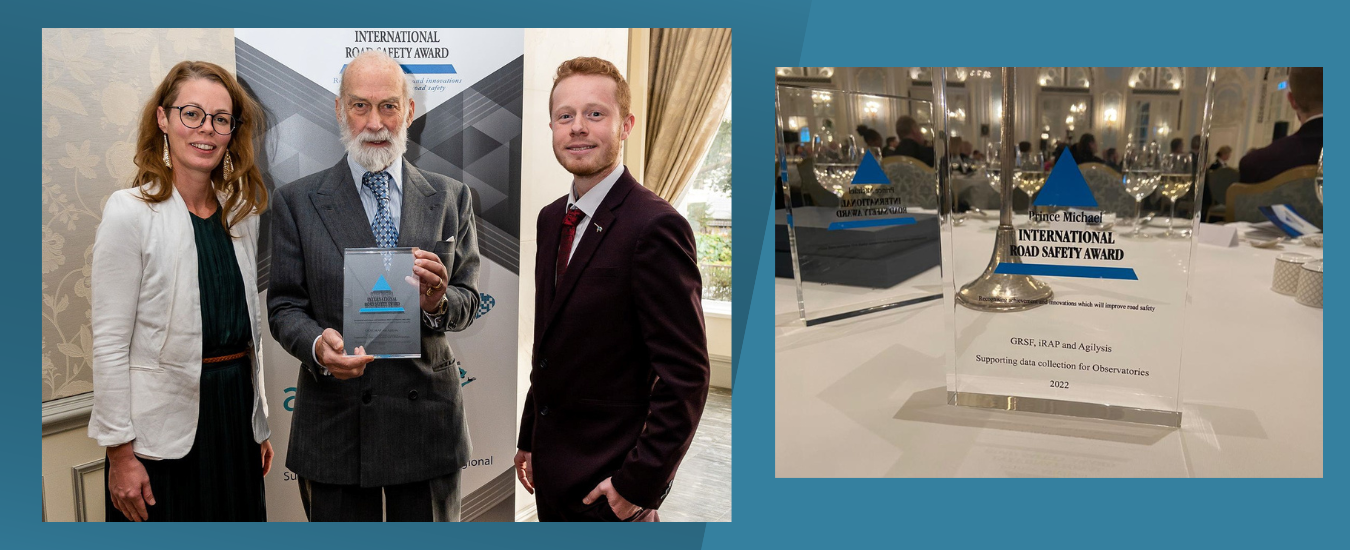
With funding from the World Bank’s Global Road Safety Facility (GRSF), iRAP and Agilysis delivered a ground-breaking research and development project to mine innovative data sources for road safety in Africa, in support of the African Road Safety Observatory (ARSO).
Novel sources of satellite and street imagery data were combined with cutting edge machine learning approaches to map where 75% of road travel occurs across Kenya and Ethiopia.
The project also developed technology to detect vehicle speeds, flow and other road features that are critical for the measuring and monitoring of road safety indicators.
There is a clear challenge of collecting relevant safety data in many countries; doing so consistently and comparably between countries is even harder.
Agilysis leveraged a variety of crowdsourced and open data from various platforms, plus satellite images from MAXAR’s ARD platform to assess more than a dozen different road attributes.
In recognising the project for this prestigious award, the judges commented that it was, “An extremely innovative project and ground-breaking for those working in LMICs, it expands on existing initiatives that have proven to be effective in increasing road safety across the world.”
Speaking about the award, Agilysis CEO, Richard Owen said, “This project brought together several years of research and development to develop an approach that works at scale. We now have the tools and expertise to conduct rapid analyses of national networks to understand key safety features.”
iRAP, the International Road Assessment Programme, who oversaw the project and evaluated the output data established that several the key metrics were being measured accurately and consistently, recognising the approach with accréditation under their AiRAP programme.
Commenting on the project’s outcomes, iRAP Global Technical Director James Bradford said, “We are working to support national governments and regional observatories in collecting vital data to help prioritise investment. New approaches like the ones explored in this project represent a major leap forward in developing data for national indicators and supporting the UN voluntary targets.”
The advanced computer vision techniques mean that the project has gone beyond national level indicators and produced road level data on the following thirteen attributes:
- Mean Vehicle Operating Speed;
- 85th Percentile Vehicle Operating Speed;
- Average Annual Daily Traffic (AADT);
- Land Use;
- Area Type;
- Speed Limit;
- Curvature;
- Carriageway Separation;
- Pedestrian Presence;
- Pedestrian Crossing Facilities;
- Pedestrian Crossing Signage;
- Street Lighting; and
- Intersection Type.
The project was made possible because of the partnership with MAXAR and the innovations in their Analysis Ready Data (ARD) platform which facilitated access to the relevant earth observation data. ARD’s pre-processed image stacks allowed the research team to procure data based on highly specified geospatial plots, reducing waste and dramatically increasing process efficiency to analyse the images.
Following the completion of the project in Summer 2023, the approach has already been used by Agilysis to deliver data for clients working in South America, Africa, South Asia, and Oceania.
– fin –
Contacts médias :
Agilysis
Dan Campsall, Chairman
Email: dan.campsall@agilysis.co.uk
Phone: +44 1295 731 812
Richard Owen, CEO
Email: richard.owen@agilysis.co.uk
Phone: +44 1295 731 815
iRAP
James Bradford, Global Technical Director
Email: james.bradford@irap.org
À propos d'Agilysis
Agilysis was set up by an experienced team, all of whom have nearly twenty years invested in transport safety. Blending expertise in research, policy and practice. Leveraging big data analytics and novel approaches Agilysis is contributing to pioneering international research as well as providing consultancy and intervention design based on evidence from a range of disciplines in the transport and health domains. Find out more at https://agilysis.co.uk/
À propos d'iRAP
est une organisation caritative enregistrée dont la vision est celle d’un monde sans routes à haut risque. L'organisation est active dans plus de 100 pays et collabore avec les gouvernements, les banques de développement, les clubs de mobilité, les organismes de recherche et les ONG spécialisées dans la sécurité routière afin de leur fournir gratuitement des outils, des systèmes et des formations pour rendre leurs routes plus sûres. La méthodologie de notation par étoiles de l'iRAP fournit une mesure simple et objective du niveau de sécurité ‘ intégré ’ à la route pour les occupants des véhicules, les motocyclistes, les cyclistes et les piétons. Une route classée 1 étoile est la moins sûre et une route classée 5 étoiles est la plus sûre. L'organisation a influencé la sécurité de plus de 1 000 milliards de dollars d'investissements dans les infrastructures, a évalué plus d'un million de kilomètres de routes et formé plus de 22 000 personnes à travers le monde. L'iRAP est le programme-cadre des programmes régionaux d'évaluation routière, notamment l'EuroRAP, le ChinaRAP, l'AusRAP, l'usRAP, le KiwiRAP, l'IndiaRAP, le BrazilRAP, le South Africa RAP, le ThaiRAP et le MyRAP. Il bénéficie du soutien financier de la Fondation FIA, du Global Road Safety Facility et de FedEx. https://irap.org/
About the Africa Road Safety Observatory
The African Road Safety Observatory (ARSO) initiative was launched in 2018. With the ultimate goal of building a robust body of data that can be used to monitor Africa’s road safety performance and improve decision making. Find out more at https://ssatp.org/topics/african-road-safety-observatory